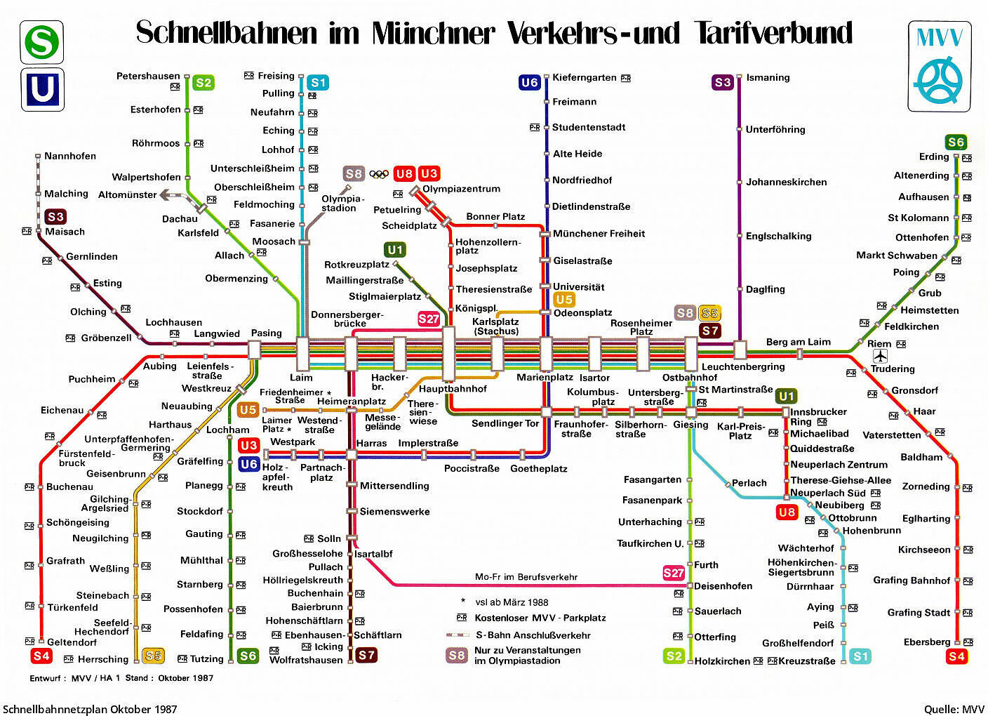
trainguard
2017-02-12 22:16:54 UTC
http://transformationinformation.co....nk-web-map.pdf
Apologies for the crap diagram. Someone in TforGM has abandoned the excellent Beck formula, but people are on his case. Note that this is not definitive; more services will be re-routed when TMS and other issues are sorted out.
The date for 2cc opening may be towards the end of February.
Clearance work and utility diversions have started in places on the Trafford Centre route.
Dr. Barry Worthington
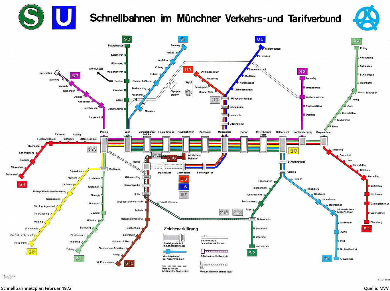